


Resolution sponsored by Togo receives support from 164 member states; US votes against, six countries abstain
Equal Earth projection shows Africa at its actual relative size, about 14 times larger than Greenland
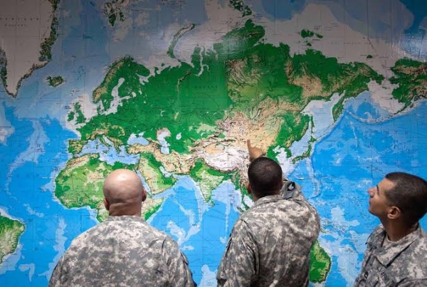
New York, 05 September (H.S.): The United Nations General Assembly on Friday endorsed a new world map that represents Africa more accurately in proportion to its actual size, marking a major development in a campaign led by African countries and advocacy groups.
The resolution, sponsored by Togo and backed by members of the African Union, was adopted with 164 member states voting in favour. The United States voted against the resolution, while Serbia, Estonia, Georgia, Lithuania, Moldova and Ukraine abstained.
The resolution encourages governments and institutions around the world to consider replacing the traditional Mercator projection, which has been widely used since the 16th century, with the Equal Earth projection. The newer map is designed to represent continents more accurately in terms of their relative size.
Under the Mercator projection, Greenland and Africa appear to be roughly similar in size. In the Equal Earth projection, which presents continents in their true proportions, Africa is shown to be about 14 times larger than Greenland.
The UN resolution does not ban the Mercator projection or make the Equal Earth projection mandatory. Instead, it encourages governments, educational institutions and other organisations to consider using maps that provide a more accurate representation of the relative size of continents.
“Maps shape our understanding of the world,” Togo's Foreign Minister Robert Dussey said ahead of the vote, according to the UN. He noted that maps influence education, imagination and collective perceptions.
Africa No Filter, one of the leading groups behind the campaign, welcomed the adoption of the resolution and called for accurate maps to be used in schools, textbooks, newsrooms, businesses and digital platforms.
Several countries also welcomed the decision and urged wider adoption of the Equal Earth projection. French Foreign Minister Jean-Noël Barrot said that changing the map would not change the world, but correcting a representation that distorts it was “already an act of truth”.
The Mercator projection was developed by Flemish cartographer Gerardus Mercator primarily to assist European navigators at sea. While the projection is useful for navigation, critics and geographers have pointed out that it enlarges areas closer to the poles, including Greenland and North America, while making Africa and South America appear relatively smaller.
The Equal Earth projection, developed in 2018, is designed to preserve the relative proportions of the world's continents while accounting for the Earth's curvature.
Geographers have said that the Mercator projection has a specific application in navigation but is less appropriate for showing the comparative size of continents in educational and general-purpose maps.
---------------
Hindusthan Samachar / Jun Sarkar

18 Aug 2026